 Arriving in Portugal.
 Portugal. It was never on my radar. And most certainly, walking Portugal was never even the merest of blips. After adventuring my way through Belize last November, I craved another adventure. I had so many countries bouncing around inside my head. Would I finally get to Nicaragua? Would it be Costa Rica? What about heading down to Panama? I just couldn't decide. I checked out Lonely Planet's Epic Hikes of the World from the library and scoured through it for ideas. I was intrigued with running Hadrian's Wall, but I'll be going to Scotland in 2020, and really had no desire to do my first multi-day walk, in the UK, in November. Europe started to intrigue me and Central America started fading from my brain. That's when I discovered the Rota Vicentina in Portugal. Hmm, Portugal. I started researching and came across a blog with extensive detail and video. I watched the entire 22 minutes and was sold. It was beautiful and I wanted to do it.
Not one travel book on Portugal I checked out from the library had any information on the Rota Vicentina or the towns I'd pass through. Blog reviews and Rota Vicentina's website became my resources. I went on impulse and booked a flight. Next thing you know, I was on Booking.com reserving beds along the walk, further cementing my plan. I was going to walk 170 km's in 8 days.
Thirty days prior to leaving, I booked a bus ticket from Lisbon to Porto Covo on Rede Expressos. Getting there was a breeze. Knowing I had 4 hours from when my plane landed to when the bus left, I took my time at the airport and had my first of many great coffees. I caught the Aerobus, which leaves from just outside Arrivals, taking me directly to the Sete Rios bus station. The bus leaves hourly and costs 4€. If I was shorter on time, I could have hopped on the Metro, getting off at the Jardim Zoológico stop, located right beside the bus station. It was a long day of travel, but at 6:15 pm, I was in Porto Covo. I walked the few blocks to my first stop, the Ahoy Porto Covo Hostel. Nicolau was a fount of information for all things Rota Vicentina. He took the time to sit with me and hash over everything. He had me download the Maps.me app, then sent me the entire route via What's App and started flagging all my accommodations on the route so I would know exactly where to go when I got to each town. Maps.me works offline with your GPS and even though the route was so well marked, it was a security blanket being able to pull up my location at any moment to ensure I was on track. I am so grateful to him for taking the time to sit with me. That night I went out for my first of many, many pizzas.
Although there were several people staying at the hostel, I had a dorm room to myself.
Accommodations: Ahoy Porto Covo Hostel
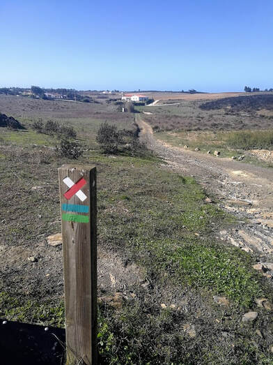
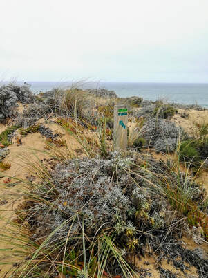 The Blue & Green stripes of the Fishermen's Way
 DAY 1. Porto Covo to Vila Nova de Milfontes
19.5 km
Elevation Gain 229 metres
5 hours
No refueling stops
Fishermen's Trail
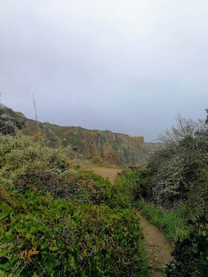
The next morning, I woke up and made coffee. There were several of us leaving within minutes of each other, but I stopped at the first of many bakeries along my journey for breakfast before ambling towards the beach. Immediately my jaw dropped. The rocky, rugged coastline stole my breath, and would continue to do so for 8 long days. The walk started gently with a mix of deep sand, single track and dirt road. When I could, I made my way down to the beach, walking across the hard sand instead of the dunes. I had bookmarks on my app (thanks again to Nicolau) to start the beach walking at Praia do Queimado and to pull back up to the Fishermen's Trail at the large parking lot at Praia do Malhão. About halfway along the beach section I made my way back to the trail, as ahead it appeared the tide was coming in, making the rocks impassible by foot. The sand was deep and made for slow moving throughout the day, but the views were absolutely spectacular. The blue and green stripes of the Fishermen's Way were signposted frequently. For moments, I felt I was on a Gary Robbins race course, minus the extra mountains he's famous for adding.
There were no places to fuel up along this section. Each day I would carry 1.5 litres of Nuun and have random snacks in my pack. Just over halfway through Day 1, I sat on a rock away from the cliff's edge in the light, misty rain and ate my leftover pizza, staring out to the stork nests atop the rocks jutting up from the sea. All in all, this was a pretty fabulous start to my first multi-day walk and I smiled like a lunatic the entire day.
Accommodations: Pirata Hostel Milfontes Once again, I had a dorm room to myself.
19.5 km
Elevation Gain 229 metres
5 hours
No refueling stops
Fishermen's Trail
The next morning, I woke up and made coffee. There were several of us leaving within minutes of each other, but I stopped at the first of many bakeries along my journey for breakfast before ambling towards the beach. Immediately my jaw dropped. The rocky, rugged coastline stole my breath, and would continue to do so for 8 long days. The walk started gently with a mix of deep sand, single track and dirt road. When I could, I made my way down to the beach, walking across the hard sand instead of the dunes. I had bookmarks on my app (thanks again to Nicolau) to start the beach walking at Praia do Queimado and to pull back up to the Fishermen's Trail at the large parking lot at Praia do Malhão. About halfway along the beach section I made my way back to the trail, as ahead it appeared the tide was coming in, making the rocks impassible by foot. The sand was deep and made for slow moving throughout the day, but the views were absolutely spectacular. The blue and green stripes of the Fishermen's Way were signposted frequently. For moments, I felt I was on a Gary Robbins race course, minus the extra mountains he's famous for adding.
There were no places to fuel up along this section. Each day I would carry 1.5 litres of Nuun and have random snacks in my pack. Just over halfway through Day 1, I sat on a rock away from the cliff's edge in the light, misty rain and ate my leftover pizza, staring out to the stork nests atop the rocks jutting up from the sea. All in all, this was a pretty fabulous start to my first multi-day walk and I smiled like a lunatic the entire day.
Accommodations: Pirata Hostel Milfontes Once again, I had a dorm room to myself.
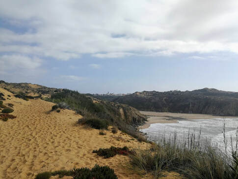 The town of Almograve in sight
 Day 2. Vila Nova de Milfontes to Almograve
16.63 km
Elevation Gain 208 metres
4 hours
No refueling stops
Fishermen's Trail
Today's section could be cut short by taking a ferry across the water, but it was a beautiful day and a short day, so I chose to walk the extra 5 km's along the road. Once across the bridge leaving town, I turned onto the trail, skirting the edges of farmland, reaching the beach across from Vila Nova de Milfontes, where the ferry would have dropped me. From here, there was a long, hot dirt road alongside farms, which I walked briefly with a lovely British couple I would see every day for the first half of my journey. Eventually the trail took me into some bamboo forests, before taking me back out to the deep sand and stunning cliffs of Southwest Portugal.
Arriving in Almograve, I made my way to the Almograve Beach Hostel. I had the entire building to myself and it was glorious! After showering and getting settled, I made my way to the small town plaza for a beer and my daily Pastela de Natas. On the trails, I wouldn't see a lot of people. But before starting each day, everyone would head to the local bakery for an espresso and some pastries. Then at the end of each day, we'd all conglomerate on a patio with a cold beer. It was here I would get to know my fellow walkers. Each day becoming friendlier as you'd see the same faces, bonding over the highs and lows of the day.
Accommodations: Almograve Beach Hostel
 Surrounded by the scent of Rockrose
 Day 3. Almograve to Zambujeira do Mar
23.40 km
Elevation Gain 477 metres
5 hours, 48 minutes
Restaurant and market in the town of Cavaleiro. Km 9.5
Fishermen's Trail
It seemed all the walkers were at the Pastelaria in Almograve this morning for a 9 am start! I grabbed some pastries for the road and drank my coffee outside, chatting with all the regular faces. Today's walk started with a shortcut direct to the beach, bypassing some deep sand. From the beach, the Fishermen's Trail followed a long gravel road running alongside the beach. Located several hundred metres apart were circuit training sites along the way. I did them all, until I came across the rings and almost dislocated my shoulder trying to do circles with my pack on. Stick to jumping jacks, Booby!
I think today was my favourite day for walking. The weather was perfect and the trail had a little bit of everything. After walking 5 km on a mix of gravel road and cliffside dunes, the trail ventured inland through groves of trees and wild thyme, before swinging back towards the cliffs. The hard rock and deep, soft sand were this eerie shade of rust. At times I felt I was walking on Mars. At 8 km, the trail turned inland past all the farms along a gravel road. I made my way to the centre of the tiny village of Cavaleiro, where I was stopping for lunch. Sitting at a picnic table in the plaza, I pulled out my bun and packet of 1.70€ prosciutto. How am I ever going to pay Canadian prices for prosciutto again? I stopped into the market to resupply my Mars and Snickers stash, and once again, was on my way.
This began the long, hot walk to Zambujeira do Mar. I headed straight back to the ocean and the Farol do Cabo Sardão, walking along the boardwalks to each cliffside viewing platform. The cliffs were simply magnificent. Although the dirt road I was on was less than 150 metres away from the cliff's edge, I felt no breeze. I was tired and it was hot, yet I still had that same stupid grin on my face. I was absolutely loving this adventure. For 2 hours, I ambled along this road surrounded by this mysterious plant, whose scent was surrounding me in the air. I knew the smell, but couldn't place it. It drove me crazy for days trying to place it. Eventually I would learn it was Rockrose. A very medicinal, resiny, gummy scent.
Finally, I descended a long set of switchbacking, rickety stairs, which reminded me of the Baden Powell trail to Lynn Valley Road. At the bottom, I began a 5 km walk alongside the road into town, ending the way I began that day, CIRCUIT TRAINING! I took a quick side trip down some rotting boardwalk towards the cliffs to see the stork nests along the rock edges.
I arrived at Hostel Nature, where I would have roommates for the first and only time this trip, then made my way to a patio for a cold Sagres and some Pastela de Natas. These were, by far, the best pastries I had ever eaten and put all other Pastela de Natas so far to shame.
Accommodations: Hostel Nature
 The waterfalls which blew up over the cliffs
 Day 4. Orange Warning Day aka "Today is the day I could die." Zambujeira do Mar to Odeceixe
18.72 km of death defying terror
Elevation gain 483 metres
4 hours 32 minutes
Fuel in Avenho do Mar, however in November it was closed
Fishermen's Trail
Melissa from Victoria, BC and I woke early and were unsuccessfully trying to figure out the coffee machine, when she said, "There's an Orange Warning today." Europe really needs to reword their weather warnings. Today should have read, "There will be wind gusts so strong, they will FUCK GRAVITY ALL TO HELL AND BLOW THE WATERFALL UP OVER THE CLIFFS!" Or maybe I should have picked up my own phone and googled 'Orange Warning', then checked the bus schedule. Instead, at 7:30 am, I naively headed South to Odeceixe and Melissa headed North to Vila Nova de Milfontes. We were idiots. We did both survive, and now have one hell of a story and absolute balls of granite.
I decided coming into this trip to forego a raincoat and take along one of those cheap ass disposable plastic rain ponchos instead. So far, taking the lighter, smaller item was a smart move. Within 3 minutes of leaving the hostel, it started to rain sideways. I pulled out my poncho and tried to get it to stay down...but it was raining sideways, which means it's also gusting wind. I tied some knots to make it tighter and less blowy, then picked up my pace. I was already known as "The Fast One" with all the walkers. Today I proved that name was well deserved.
At 3.5 km, I was still in denial about the storm. The rain had lessened almost immediately. I no longer needed the poncho and had already switched out to my Icebreaker windbreaker. It got wet, but the merino kept me warm. It was when a truck pulled up next to me at the Safari and said while pointing in the direction of the ocean, "There's bad weather coming." to which I replied, with a big ass smile on my face, "I heard!", and they responded seriously, "Good luck.", that I realized shit's about to go down. And go down, it did.
 Orange Warning
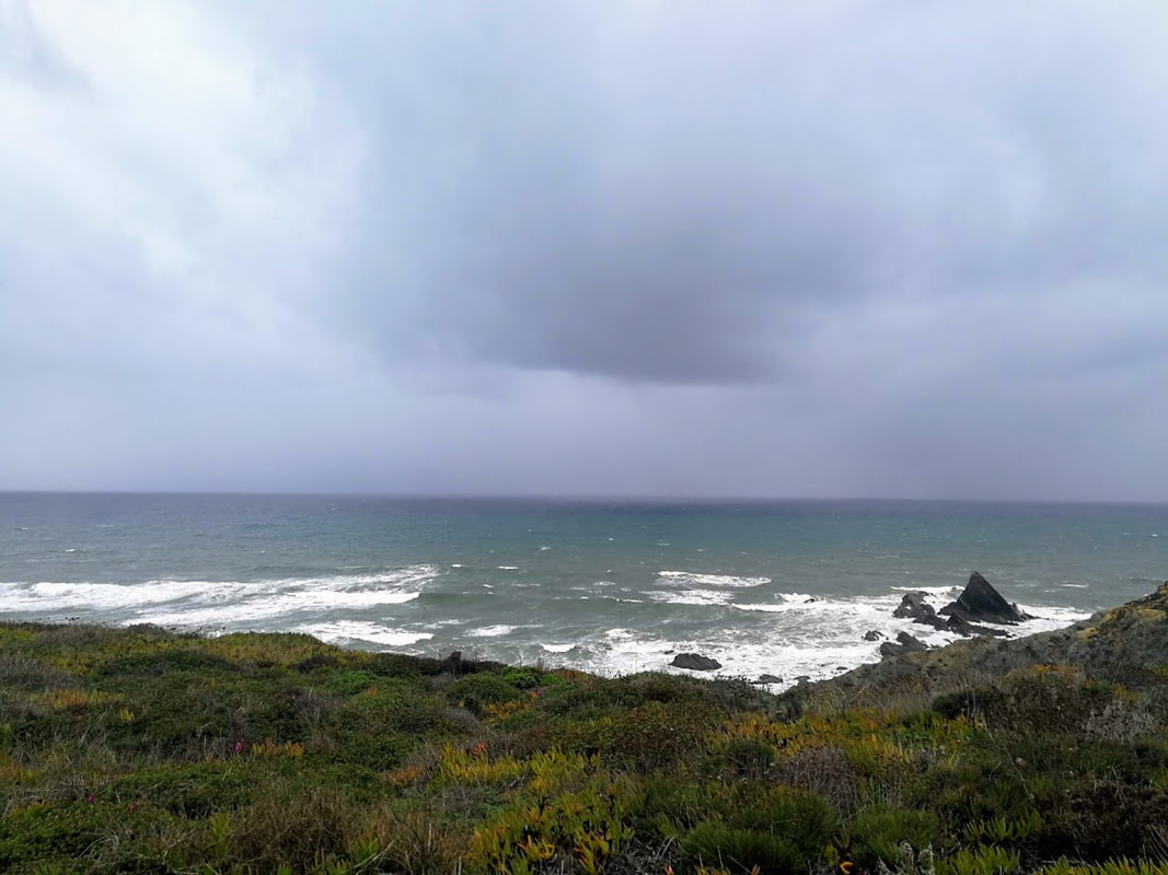
 It was dark and gloomy all morning. At points I would get into narrow trails through trees, ducking through bamboo forests next to a stream. This would have been fun the previous day, but today, my entire focus was on getting to Odeceixe in one piece. For hours I would repeat with every step, "Just stay safe. Just stay safe. Just stay safe." At about 6 km, I could see 3 waterfalls in the distance. It was one of the rare occasions I took a photo that day. The trail took me briefly away from the beach, edging alongside a farm, before taking me out to the dreaded cliffs above the waterfalls. I was suddenly getting rained upon hard, but I couldn't figure out why the drops were so big. It was then I looked about 20 feet away to the cliff's edge and saw water spraying upwards. It took me a moment, then I realized the wind gusts were so strong, it was blowing the waterfall up over the cliffs. That was my a-ha moment. The time in the day when I realized, I could actually die today. This definitely didn't help my rapidly darkening mindset.
 The dirt roads were my salvation for 2 km
 I hunkered down between some sand dunes and pulled out my phone to see if there was any way to get away from the cliffs. I saw some lines on the Maps.me app that paralleled the cliffs, but were about 75 metres inland, and ran for them. There was no getting away from the fear racing through my mind. It was my own worst enemy, making things much worse than they had to be. But at least here, I no longer felt I was going to be swept off a cliff. The dread stayed forefront in my head, knowing at some point, I would have to head back out to the cliffs. But for two glorious km, I felt safe.
It was a short, steep climb out of Azenha do Mar, and then I was back on those dreaded cliffs. For the rest of the day, the trail was thankfully at least 50 feet from the cliff's edge. Panic was subsiding, but I had no idea what was ahead, so the dread stayed forefront in my mind. I often checked my location on the maps.me app to see how close I was to turning inland. The closer I would get, the more my mind would ease. When I finally arrived where the river meets the sea, I felt relief. I just had to work my way past the farm, down the rocky path to the road below. I have never been so grateful to walk 4 km on paved road at sea level. Walking by a field with over 100 cows, all wearing cowbells, it was a beautiful sound of constant singsong jingling and put a long deserved smile on my face. Finally I made it to Hostel Seixe and immediately messaged Melissa to make sure she was in one piece.
Accommodations: Hostel Seixe
Amazingly, I had the building to myself again.
 Looking towards the coast. The storm is still present, but swiftly moving ahead
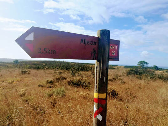
 Day 5. Odeceixe to Aljezur
23.69 km
Elevation Gain 274 metres
5 hours 37 minutes
Fuel in Rogil at 10 km
Historical Way
Circular Route Praia da Amoreira
Odeceixe is the point in the Rota Vicentina where the Historical Way and the Fishermen's Trail meet. From here on, each day I could head to the coast or stay inland. Orange Warning was still in effect until 3pm, so that morning I followed Nicolau's route on the Historical Way. In less than 1 km, while still in the town of Odeceixe, I lost the Red and White stripes of the Historical Way. I backtracked, but the last sign I saw conflicted with what I had on my app. Nicolau hadn't steered me wrong yet, so I followed his tracks. 1 km later I could see where the markings of the Historical Way had been painted over. This worried me, but after checking my map, I realized that worse case, I could follow roads to Rogil, the halfway point to Alejzur.
 Some of the different signage and coloured markings of the Rota Vicentina
 My route took me alongside the canals and the only souls I saw were farmers. I was halfway to Rogil when I stepped onto a road just as a cyclist was coming by. He was from the UK and cycling the canals from Rogil that day. It was from him I learned this was the old Historical Way. The new route was quite a bit to the East to avoid any damage to the canals. This explained why all my signage was painted over. Carrying on along the unmarked canals, mountain bike treads became my new markers. If I saw his bike tracks, I knew I was heading to Rogil. At the outskirts of town, I saw my first red and white stripes and it was an absolute joy. I found a picnic table in the middle of town and pulled out some bread and prosciutto to nosh down. There was a public washroom in the tiny square, then off I went, excited to finally be following markings after a 10 km mystery adventure! The route from Rogil followed a long, straight gravel road for 3 km. I felt I could see for miles in each direction. And for a 2nd day in a row, there was not a soul to be seen.
At 14.5 km there was a fork in the road. I could carry on with the Historical Way, 5.5 km to Aljezur, or I could do a 5 km loop out to the coast, then carry on to Aljezur. After yesterday's storm, you couldn't have paid me to head towards the coast when I woke up this morning. But for the last hour, looking out towards the coast, I could see the storm moving ahead of me. I was eager to get my confidence back on the cliffs, so right I turned towards the beach. A sand road took me 2 km to the ocean where I fell back in love with walking on the cliffs. It was exactly what I needed to get past yesterday. The sun was shining, the storm had moved south, and I was once again walking the dunes. As much as I loved the countryside, there is just something so special being on the cliffs in southwest Portugal. Sadly, after only 1.5 km, the signs had me turn inland at Praia da Amoreira. Once again, surrounded by the scent of Rockrose, I made my way to the top of the climb, then down a steep rocky road to the town of Aljezur, past 8 large barking dogs, which were thankfully behind a big fence!
Accommodations: Daguasoul Hostel
I had a dorm room to myself. There is an honour bar with bottles of water, juice, yogurt and a giant Nespresso machine. We had the fireplace crackling that night and it was wonderfully cozy and warm.
 Stick People!! This way!
 Day 6. Aljezur to Carrapateira
30 km
Elevation Gain 510 metres
6 hours 39 minutes
Fuel in Arrifana Km 12
Historical Way to Arrifana
Fishermen's Trail from Arrifana to Carrapateira
With my decision to double up today's route, bypassing a stop in Arrifana, I planned my fueling very poorly. The previous night in Aljezur I had forgotten to replenish my snacks. I grabbed 2 bottles of water and one of juice in the honour bar at the hostel, with the hopes the juice would give me a sugar boost later in the day. For the duration of 30 km I had 2 Skratch bars, a bunch of grapes, and a handful of Oreo's. I also had no fueling stops along the way, and carried a total of 3 litres of liquid. I didn't have one Snickers or Mars bar hidden away, both which had been fueling my entire walk thus far. It was a very hilly day through the mountains.
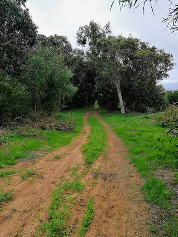
Leaving Aljezur, I began my way up a steep 100 metre dirt road past what looked like some new development under construction. I felt like I was back on the North Shore, where every trail run starts with a climb up the mountain, except on the steep downhill, I was surrounded by baby Eucalyptus trees. I pulled a tiny branch off and put it in my front chest pocket. The scent was absolutely wonderful. It was a long day today, and whenever I started to feel low on energy, which was often with my lack of supplies, I rubbed the leaves between my fingers and inhaled. It made me smile every single time.
30 km
Elevation Gain 510 metres
6 hours 39 minutes
Fuel in Arrifana Km 12
Historical Way to Arrifana
Fishermen's Trail from Arrifana to Carrapateira
With my decision to double up today's route, bypassing a stop in Arrifana, I planned my fueling very poorly. The previous night in Aljezur I had forgotten to replenish my snacks. I grabbed 2 bottles of water and one of juice in the honour bar at the hostel, with the hopes the juice would give me a sugar boost later in the day. For the duration of 30 km I had 2 Skratch bars, a bunch of grapes, and a handful of Oreo's. I also had no fueling stops along the way, and carried a total of 3 litres of liquid. I didn't have one Snickers or Mars bar hidden away, both which had been fueling my entire walk thus far. It was a very hilly day through the mountains.
Leaving Aljezur, I began my way up a steep 100 metre dirt road past what looked like some new development under construction. I felt like I was back on the North Shore, where every trail run starts with a climb up the mountain, except on the steep downhill, I was surrounded by baby Eucalyptus trees. I pulled a tiny branch off and put it in my front chest pocket. The scent was absolutely wonderful. It was a long day today, and whenever I started to feel low on energy, which was often with my lack of supplies, I rubbed the leaves between my fingers and inhaled. It made me smile every single time.
 Leaving the Historical Way for the Fishermen's Trail
 Had I only being going to Arrifana today, I would have taken the Fishermen's Trail to be along the coast. I am so glad I listened to Nicolau and took the shorter Historical Way, before switching to the Fishermen's Trail after Arrifana. It was simply stunning walking through the mountains, surrounded on all sides by more hills. It was so different from all my previous days walking. After two hours, I came to the junction where I could go into Arrifana or continue on to Carrapateira. I was very tempted to head into town for some supplies, but the thought of adding an extra 4 km out and back onto an already long 30 km day had me sitting my ass on the ground, reapplying a blister gel to my foot, and pulling out my rationed Oreo's instead. Already 12 km into the day's journey, I still had another 18 km to go, so I got off my ass, and sauntered along the dirt road.
I had a brief teaser of the ocean south of Arrifana, then swung back inland up another steep 150 metre climb. Within two hours, I was back on the Fishermen's Trail heading gradually towards the coast. Descending the rocky path towards the Praia da Bordeira, I had two routes I could take. Nicolau's suggestion was to descend all the way to the beach, walk across the beach, and take the road right into town. This option was dependent on the tides. The second route would be to take the trail alongside the river a ways, then back the other side of the river, along the road into town. Option one would be much faster, and even though I could see a couple of people on the beach, the tide schedule for the day was not in my favour. I probably could have taken that route, but the thought of getting down there, walking 1.5 km on the beach and then having to walk back the 1.5 km because the tide was too high, followed by another 6 km on my longest day, made option two the logical one. Damn you logic. That was the longest 6 km in my life, after Orange Warning day of course. The sun was beating down. It was hot. After 5 1/2 hours, I was getting pretty damned hangry, and now I stepped into the deepest sand dunes of the entire trek. I just wanted to cry, and every time I checked my map, I didn't feel any closer to town.
I went immediately to Hostel do Mar and showered. Then I was off on a hunt for food. Every day so far, when I arrived in towns, restaurants were closed for lunch. You could get drinks and sometimes pastries, but they were no longer serving food until they reopened for dinner at 7pm. Today of all days, I wept with joy seeing a restaurant with people eating full meals. I hightailed it over to a patio table and ate the biggest burger ever. Not only did it have the regular fixings, it was covered in cheese, slices of chorizo and a big ass fried egg. I inhaled it all and devoured the chips that came with it, alongside a couple of Sagres. Delightful.
Accommodation: Hostel do Mar
I had a dorm room to myself.
 Donut Break!
 Day 7. Carrapateira to Vila do Bispo
16.65 km
Elevation Gain 417 metres
4 hours 27 minutes
No refueling stops
Fishermen's Way
After leaving the restaurant yesterday afternoon, I was desperate to find snacks for my walk the following day. The market in the town square was closed and when I looked online, it wasn't reopening until Tuesday. It was only Sunday. Knowing there were no refueling spots until arriving in Vila do Bispo, I was down to 3 Oreo's. In desperation, I went out again later that evening and squealed in delight when I saw it had opened up. I stocked up. Three YES! nut bars, three Mars bars, a pack of mini chocolate covered donuts, two pears and a tin of octopus. I was set and oh so giddy.
I left Carrapateira on a dirt road heading out to the coast, once again blown away by the ruggedness of the cliffs. I spent some time eating donuts at Praia do Amado before making my way up the first climb to the cliffs. Even though so much of the walk is along the coast, it's not very often you get to be on the beach. Usually you are so high up on the cliffs, the beaches aren't accessible unless you're totally mad like those crazy fishermen who scale their way down. Today I was able to pass along 3 beaches, which also meant many ups and downs to get back to the cliffs. It was coming down the narrow path to the second beach, Praia da Murração, that I noticed at least one hundred goats on the hill. GOATS!!! I was serenaded by a constant baa'ing and jingling of bells. As I walked across the beach to get on the dirt road climbing back up to the cliffs, I saw the goat shepherd walking with his dogs, two which were skipping their goat herding duty to play on the beach. Somehow he managed to call his goats off the hill onto the road for a climb. I passed him and said, 'Bom Dia!', then grinned like a lunatic as I made my way up the 1 km climb to the top surrounded by goats. I was amazed at how much faster I was able to climb on Day 7, not even breathing hard anymore.
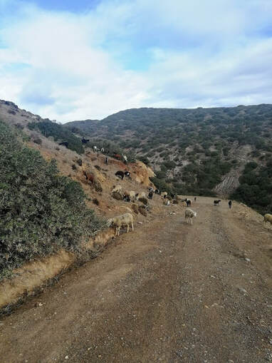 Surrounded by goats
 The signage coming out of the tiny third beach was non-existent. I tried using the maps.me app to figure it out, but ended up heading too far inland. Thankfully I realized something was off after only 100 metres and started scouring the countryside for the blue and green stripes. Finally I saw a sign post up on the hill in the distance and started to make my way in that direction. It was fairly narrow and bushy, and a little washed out from all the rain at the top, which led to a little bit of scrambling up a few feet of loose dirt and rock to get onto the path at the top. From here it was a 4 km flat dirt road leading me to the main road into Vila do Bispo. The trail ran parallel to the road, but off to the side so there was no worry about traffic. I sat in the small town square eating my tin of octopus, while I waited for access to my b&b.
Throughout the day, I kept realizing that after today, I only had one more day until walking the Rota Vicentina came to an end. I couldn't believe how fast everything had gone by and how much I really, really enjoyed travelling by foot.
Accommodation: I was booked in Pure Flor de Esteva Bed and Breakfast, but they upgraded me to their sister site, Pure Fonte Velha.
It was my first night outside of a hostel and it was exceptional.
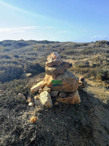 One of many cairns marking the way
 Day 8. Vila do Bispo to Sagres
21.6 km
Elevation Gain 341 metres
5 hours
No refueling stops
Historical Way for first 6 km
Fishermen's Trail to Sagres
The route today starts along the Historical Way on a dirt road passing by farms full of sheep. From almost the start, you could see not only the lighthouse of Cabo de São Vicente in the distance, but Sagres was also visible. Being able to see them filled me with so much anticipation and excitement. It was hard to believe these were the final steps of my journey. I made my way along the dirt road and at 10 km, reached the cliffs above Praia do Telheiro. From hereon, the quiet solitude I cherished the previous 7 days would fade and I was forced to embrace the multitude of day hikers between here and the lighthouse. It was odd how different they were. Previously, when I would encounter people on the trail, it was so rare to see someone that you would always take the time to chat. But now? You would sometimes not even get a hello in response. The exception was the British couple in maybe their 60's who came along as I stopped for a snack. We chatted for ages, before both heading in separate directions. I missed them as soon as we split. Like me, she had been rebuilding the cairns along this mostly unmarked section.
The path became scattered, uneven limestone. It was easy to see how someone could roll an ankle along this last section. The signs of Fishermen's Trail were scarce, but there were cairns built up so frequently, it was impossible to lose your way.
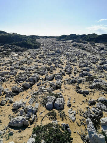 Limestone path to Cabo de São Vicente
 Walking those final 500 metres along the road to Cabo de São Vicente, I was filled with such a feeling of accomplishment. I still had 6 km to get to Sagres, but it was here where it felt the trail ended. I had to laugh when I arrived at the gates to the Lighthouse and they were locked. It must have just closed, as the British couple had been inside the courtyard. I sat outside and pulled out a celebratory Mars bar, savouring every bite. The wind was absolutely howling. It is the most southwesterly point of Europe, and until the 14th Century, was known as the end of the known world. Even surrounded by tourist stalls and hordes of people, it felt so wild and rugged.
After taking a last look around, I started back along the road towards Sagres. Sometimes I would follow the blue and green stripes off road towards the cliffs, but for the most part, I stuck to the road, just ambling along the final 6 km to Sagres. Compared to all the small villages I had spent time in since arriving in Portugal, Sagres was huge! It was still a small town, but I was going to have so many dinner options tonight!
That evening I went to the Fortaleza de Sagres, the large Fortress on the cliffs for sunset. It was so cold, but the gentleman at my hotel had told me the sunsets this week had been spectacular with the pinks from the clouds. I was determined to stay. The funniest moment occurred when I had to pee. Being out in the open, surrounded by the same shrubs I had walked past the previous eight days, I had to actually tell myself, "Booby. It is no longer okay to just squat next to a bush to pee." I had paid entrance to a tourist sight, I was no longer in the wild countryside of Southwest Portugal. I had to remind myself numerous times over the next few days.
Accommodations: Casa Azul Sagres
There was a Christmas Tree!!!!
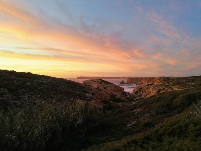
Sunset from the Fortress
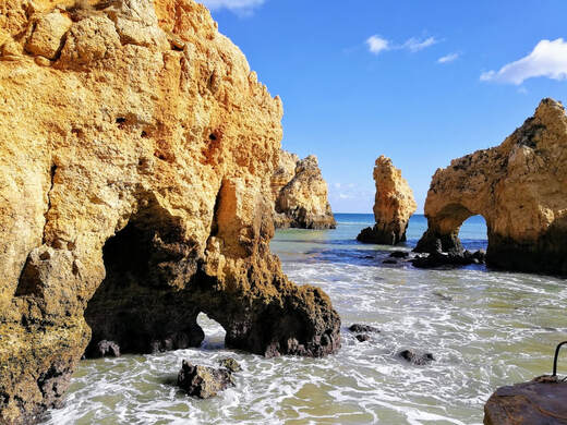 Ponta da Piedade
 I took a bus to Lagos and spent several days there. Since completing the Rota Vicentina, each morning I would feel as if I had no purpose. Eight days of getting up, grabbing coffee and pastries, and then walking 4 to 7 hours became habit. So now to wake up with no agenda, I was at a loss as to what to do. I wished I could have kept walking. It was on my second day in Lagos that I saw the blue and green striped signpost marking Fishermen's Trail while exploring Ponta da Piedade. My jaw dropped and I thought, "I could have kept walking? DAMMIT!"
So used to the hammering waves crashing into the rocks, the water was so calm in comparison along the southern coast of Lagos. I joked after being along the cliffs for 8 days, it was like being at the Vatican, where you walk down hallway after hallway, in awe of the painted ceilings, to finally get to the Sistine Chapel and by then it's just another painted ceiling. But the cliffs and rocks in Lagos were just stunning.
Accommodation: Hotel Mar Azul
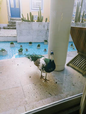 One of many screaming peacocks
 After 3 days in Lagos, I caught a bus back to where it all began, the Sete Rios station in Lisbon. Was I ever glad I wasn't walking that day. Another orange warning had arisen and the rains were absolutely torrential as the bus made it's way along the highway to Lisbon. Looking at the paths inland from the road, it was just one long slip 'n slide mud puddle. I would have been absolutely drenched. As soon as we pulled into the outskirts of Lisbon, there were glimpses of blue sky. I couldn't believe my luck. I caught the Metro from Sete Rios to Terreiro do Paço. From here I walked past the Arco da Rua Augusta before winding my way up the twisting Alfama streets to Solar do Castelo, located right beside Castelo de S. Jorge. My first twelve nights accommodation cost me a ridiculously cheap $550 CAD. I was so far under budget, I absolutely had to splurge in Lisbon. My two nights in Lisbon cost $550 CAD and I didn't care! When I looked out the window beside my bed, the castle was right there. The peacocks would wake me each morning with their screaming. My hotel was so close to the castle, the castle peacocks would come over to our courtyard during breakfast. PEACOCKS! Each night I would make my way back up the winding streets of Alfama to the hotel, having to pass through the castle gate. Splurge complete.
Lisbon is a fascinating city. I worried it would be just another big city, but there is just so much character everywhere you turn. With the exception of getting to/from the airport and Sete Rios bus station, I walked everywhere. It's a very easy city to get around and there is something for everybody. My favourite place in all of Lisbon had to be the Time Out Market. I ate there both days and it was superb. It's like a giant food fair, but with 4-star meals with wine and beer. And no dingy paper plates. Everything was served on proper dishes and glassware. Granville Island needs to step up their game!
Lisbon is a fascinating city. I worried it would be just another big city, but there is just so much character everywhere you turn. With the exception of getting to/from the airport and Sete Rios bus station, I walked everywhere. It's a very easy city to get around and there is something for everybody. My favourite place in all of Lisbon had to be the Time Out Market. I ate there both days and it was superb. It's like a giant food fair, but with 4-star meals with wine and beer. And no dingy paper plates. Everything was served on proper dishes and glassware. Granville Island needs to step up their game!
I packed ridiculously light for this trip, only carrying 4.5 kg in my pack. I had no idea what to expect or how difficult it would be to carry everything I had each day, so I went as light as I could. I definitely wasn't lacking anything, and I probably could have gone even lighter. After two days of walking, the only time I would actually notice the weight of my pack was when I swung it up on my back each morning. From then on, it just became a part of me.
I honestly can't believe how much I enjoyed this trip, especially the walking. There were a few lows, but so many unbelievable highs. For the most part, I had a stupid ass grin on my face from when I stepped foot on the path each morning until I reached my accommodations later that afternoon. I think November is a fantastic time to do this hike. It's slightly off-season, which means many restaurants, shops, and accommodations were closed. I booked everything in advance, but it wasn't necessary. I had a dorm room to myself in all but one town. The temperature was fairly cool. There was one 20 C day, but for the most part, it was around 14 C each day. Often sunny, sometimes drizzling, sometimes sideways downpour. While walking, I wore shorts and either a tank top or t-shirt every day. If it felt cooler, or started to monsoon, I would throw on my windbreaker and either my toque or ball cap. Orange Warning storm day was the only time I attempted to use waterproof gear, and that was only the disposable poncho for 5 minutes.
Recommendations for the Rota Vicentina:
Check the tide reports the night before each walk. There are several days where you need to cross beaches that are tide dependent.
Book in advance. It's not necessary during part of the year, but who wants to get to town after 6+ hours of walking and try to find accommodations?
Check the weather. Seriously. Orange, or the deadlier Red warnings, are no joke. "Damage and casualties are likely to happen."
Get the maps.me app and download all the official routes from the Rota Vicentina website. As well as the trail is marked, there were several detours that had no markings. Being able to pull up a back up plan and hit your GPS was the security blanket I needed at times.
Merino is your friend. You can wear it for days on end without it stinking. It dries fast and layers well. If it gets wet, it will still keep you warm. If it's warm, it will keep you cool. Sheep are magic.
GEAR:
- Ultimate Direction FastPackHer 30 litre pack. I had plenty of space in my pack.
- Inov8 Trailtalon 235 Trail Running Shoes. I don't own hiking boots, and they definitely weren't needed for this walk. With the terrain being mostly sand or dirt roads/paths, I was perfectly comfortable in trail running shoes. I had a pair of flip flops and Toms for use outside the walk.
- Dirty Girl Gaiters
- 1 pair of Darn Tough socks and 2 pairs of Smartwool Ultra Light socks. All 3 pairs were running specific socks rather than hiking socks because it was what my feet knew.
- 2 Smartwool Merino Sport 150 t-shirts, 1 Icebreaker Cool-Lite Amplify Tank, & 2 Icebreaker Merino long sleeve shirts
- 1 pair of Icebreaker Cool-Lite Impulse Training Shorts. I freaking love these shorts. It was like sheep were caressing my ass every day. 2 extra pairs of shorts which were only used after walking or in Lisbon and Lagos.
- 1 Icebreaker Cool-Lite Rush Windbreaker. Super lightweight and slightly water resistant. With the merino lining, even when wet, I was always warm. It also dried extremely fast. I'm fortunate that I live close to the Icebreaker Outlet store at YVR. The woman working there recommended many great pieces for my trip, but this was by far the greatest item I took on my trip.
- 2 Hydrapak soft flasks and one GSI Outdoor MicroLite 500 Twist for a total of 1.5 litres of liquid
- 1 pack of Adventure Medical Kits Glacier Gel Blister/Burn Dressing. I had a blister form on Day 2. I would put one of these patches on each morning and wouldn't even notice the blister until the patch fell off when I would pull my sock off at the end of the day.
- Petzl Reactik+ headlamp
- Merino gloves, merino toque, ball cap, sunglasses, hairband. Out of all these, the hairband got used daily to keep the wind from blowing my hair everywhere. The rest were rarely, if ever, used, but I was thankful to have them all just in case.
- 1 pair of pants for after walking. Although most walkers I saw wore pants, I was in shorts every day and never felt cold.
- Toiletries and chargers
 RSS Feed
